Checked
Vancouver neighbourhoods: a guide to the 22 local areas
Vancouver, British Columbia, Canada
A plain guide to all 22 City of Vancouver local areas: where each one is, what housing is like, SkyTrain stations, parks, community centres, libraries and schools in Vancouver, British Columbia.
Key information
The City of Vancouver splits the city into 22 local areas. Downtown and the West End fill the downtown peninsula. Eight areas make up the west side, seven the east side, and five South Vancouver near the Fraser River. Each area below lists its housing, SkyTrain stations, biggest parks, community centres and library branches.
On this page
All 22 Vancouver local areas at a glance
| Local area | Part of the city | Land area (hectares) | Park Board parks | SkyTrain stations | Library locations |
|---|---|---|---|---|---|
| Downtown | Downtown peninsula | 464 | 23 | 7 | 3 |
| West End | Downtown peninsula | 224 | 8 | 0 | 1 |
| Kitsilano | West side | 632 | 16 | 0 | 1 |
| Fairview | West side | 361 | 7 | 1 | 1 |
| West Point Grey | West side | 526 | 7 | 0 | 1 |
| Arbutus Ridge | West side | 367 | 10 | 0 | 0 |
| Shaughnessy | West side | 445 | 5 | 0 | 0 |
| South Cambie | West side | 216 | 5 | 0 | 0 |
| Dunbar-Southlands | West side | 902 | 8 | 0 | 1 |
| Kerrisdale | West side | 656 | 9 | 0 | 1 |
| Strathcona | East side | 434 | 6 | 1 | 1 |
| Mount Pleasant | East side | 369 | 13 | 1 | 1 |
| Grandview-Woodland | East side | 472 | 14 | 1 | 1 |
| Hastings-Sunrise | East side | 827 | 16 | 0 | 1 |
| Kensington-Cedar Cottage | East side | 720 | 11 | 1 | 1 |
| Renfrew-Collingwood | East side | 804 | 15 | 5 | 2 |
| Riley Park | East side | 490 | 7 | 1 | 1 |
| Oakridge | South Vancouver | 399 | 5 | 2 | 1 |
| Marpole | South Vancouver | 596 | 11 | 1 | 1 |
| Sunset | South Vancouver | 653 | 6 | 0 | 1 |
| Victoria-Fraserview | South Vancouver | 546 | 7 | 0 | 1 |
| Killarney | South Vancouver | 688 | 9 | 0 | 1 |
The City of Vancouver uses 22 local areas to plan and deliver services. The groups below (downtown peninsula, west side, east side and South Vancouver) are our way of reading the map; they are not official City districts.
Sources: Areas of the city, City of Vancouver · City of Vancouver Open Data: Local area boundary · City of Vancouver Open Data: Parks · City of Vancouver Open Data: Rapid transit stations · City of Vancouver Open Data: Libraries
How Vancouver neighbourhoods are named
The 22 local areas are the official units the City uses for planning, services and census profiles. The City says there is some disagreement about names and boundaries, and its Areas of the city page also lists smaller places such as Gastown, Chinatown, Yaletown, Coal Harbour, Commercial Drive, Hillcrest and Champlain Heights.
Stanley Park sits outside all 22 local area boundaries. Main Street is the usual line between the west side and East Vancouver.
Sources: Areas of the city, City of Vancouver · City of Vancouver Open Data: Local area boundary · Dog off-leash areas, City of Vancouver
Downtown peninsula neighbourhoods
The downtown peninsula sits between Burrard Inlet and False Creek, with Stanley Park at its western tip. It is the densest part of the city and has most of its SkyTrain stations.
Downtown
Downtown, Vancouver, BC
Downtown is Vancouver's main business district and the home of many arts, entertainment and sports venues. It fills the peninsula between Burrard Inlet and False Creek, with Yaletown to the south and Gastown and Chinatown to the east.
The city grew from Gastown, then called Granville. Granville Street became the centre of downtown in the 1890s.
The City data counts 23 Park Board parks here (32.1 hectares in total). The largest are Devonian Harbour Park, David Lam Park, Andy Livingstone Park.
- Land area
- About 464 hectares (calculated from the City boundary)
- Housing
- High-rise apartments and offices
- Known for
- Business district, Yaletown, Gastown, Chinatown, sports and arts venues
- SkyTrain stations
- Burrard, Granville, Main Street - Science World, Stadium - Chinatown, Vancouver City Center, Waterfront, Yaletown - Roundhouse
- Community centres
- Roundhouse, Gathering Place Community Centre, Coal Harbour, Carnegie Centre
- Library branches
- Outreach Services, Carnegie, Central Branch
- Schools in City data
- 2 public, 5 independent
- Dog off-leash parks
- CRAB Park at Portside, Coopers' Park, Emery Barnes Park, Andy Livingstone Park, Devonian Harbour Park
Sources: Downtown, City of Vancouver · City of Vancouver Open Data: Local area boundary · City of Vancouver Open Data: Parks · City of Vancouver Open Data: Community centres · City of Vancouver Open Data: Libraries · City of Vancouver Open Data: Rapid transit stations · City of Vancouver Open Data: Schools
West End
West End, Vancouver, BC
The West End sits west of downtown and is bordered on three sides by water: English Bay, Coal Harbour and Lost Lagoon in Stanley Park. The City calls it a high-density area with recreation within walking distance.
It includes Davie Village, Denman Street and shopping on Robson and Alberni streets.
The City data counts 8 Park Board parks here (416.3 hectares in total). The largest are Stanley Park, English Bay Beach Park, Sunset Beach Park.
- Land area
- About 224 hectares (calculated from the City boundary)
- Housing
- High-density apartments
- Known for
- English Bay Beach, Davie Village, Denman Street, Stanley Park next door
- SkyTrain stations
- none listed
- Community centres
- West End
- Library branches
- Joe Fortes
- Schools in City data
- 3 public, 0 independent
- Dog off-leash parks
- Nelson Park, Sunset Beach Park, Stanley Park (beside the tennis courts)
Sources: West End, City of Vancouver · City of Vancouver Open Data: Local area boundary · City of Vancouver Open Data: Parks · City of Vancouver Open Data: Community centres · City of Vancouver Open Data: Libraries · City of Vancouver Open Data: Rapid transit stations · City of Vancouver Open Data: Schools
Sources: Areas of the city, City of Vancouver · Downtown, City of Vancouver · West End, City of Vancouver
West side neighbourhoods
The west side runs from False Creek and English Bay south toward the Fraser River, west of Main Street. It mixes apartment areas near Broadway and the beaches with older streets of large houses further south and west.
Kitsilano
Kitsilano, Vancouver, BC
Kitsilano, or Kits, runs along the south shore of English Bay between Granville Island and Point Grey. It is known for Kits Beach and for shops and restaurants on West 4th Avenue and West Broadway.
The Coast Salish village of Snauq stood on the False Creek shore nearby, and the Kitsilano Indian Reserve was on what is now Vanier Park.
The City data counts 16 Park Board parks here (48 hectares in total). The largest are Vanier Park, Kitsilano Beach Park, Connaught Park.
- Land area
- About 632 hectares (calculated from the City boundary)
- Housing
- Mix of apartments and houses
- Known for
- Kits Beach, West 4th Avenue, Vanier Park, Museum of Vancouver, Vancouver Maritime Museum
- SkyTrain stations
- none listed
- Community centres
- Kitsilano Community Centre, Kitsilano Ice Rink, Kitsilano Pool
- Library branches
- Kitsilano
- Schools in City data
- 5 public, 6 independent
- Dog off-leash parks
- Hadden Park (dog beach)
Sources: Kitsilano, City of Vancouver · City of Vancouver Open Data: Local area boundary · City of Vancouver Open Data: Parks · City of Vancouver Open Data: Community centres · City of Vancouver Open Data: Libraries · City of Vancouver Open Data: Rapid transit stations · City of Vancouver Open Data: Schools
Fairview
Fairview, Vancouver, BC
Fairview runs from Granville Island along False Creek to Science World and south toward Shaughnessy. It includes Granville Island and the South Granville gallery district.
Granville Island was built in 1916 from soil dredged out of False Creek.
The City data counts 7 Park Board parks here (13.2 hectares in total). The largest are Charleson Park, Sutcliffe Park, Granville Park.
- Land area
- About 361 hectares (calculated from the City boundary)
- Housing
- Mostly apartments and condos
- Known for
- Granville Island, South Granville, Olympic Village area
- SkyTrain stations
- Olympic Village
- Community centres
- False Creek
- Library branches
- Firehall
- Schools in City data
- 5 public, 2 independent
- Dog off-leash parks
- Charleson Park, Granville Park
Sources: Fairview, City of Vancouver · City of Vancouver Open Data: Local area boundary · City of Vancouver Open Data: Parks · City of Vancouver Open Data: Community centres · City of Vancouver Open Data: Libraries · City of Vancouver Open Data: Rapid transit stations · City of Vancouver Open Data: Schools
West Point Grey
West Point Grey, Vancouver, BC
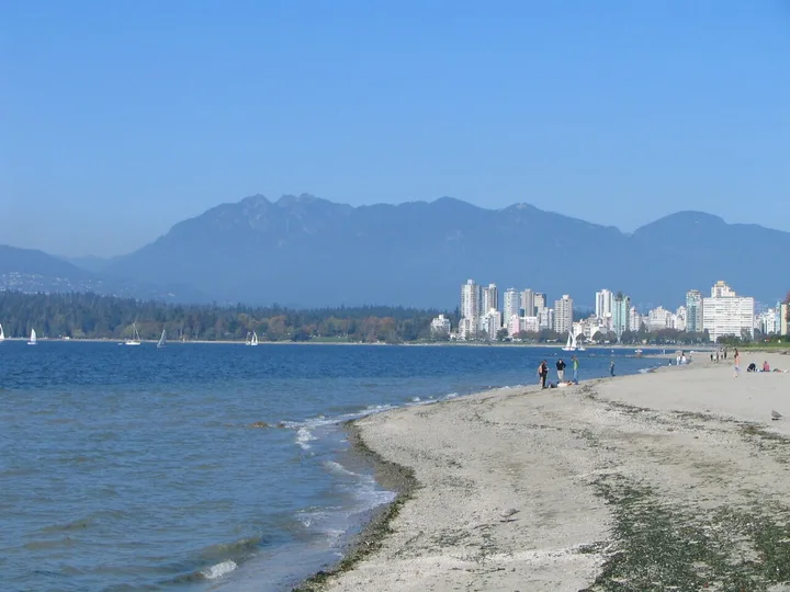
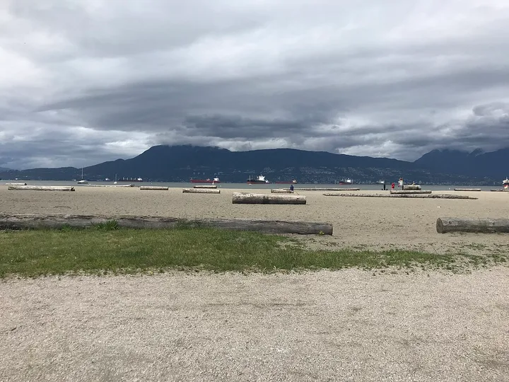
West Point Grey runs along English Bay between Kitsilano and the University of British Columbia. Point Grey Village is its shopping street.
The Musqueam village of Ee'yullmough was here. Jericho Beach and Spanish Banks are the area's best-known beaches.
The City data counts 7 Park Board parks here (77.3 hectares in total). The largest are Jericho Beach Park, Locarno Park, Spanish Banks Beach Park.
- Land area
- About 526 hectares (calculated from the City boundary)
- Housing
- Mostly houses, many long-time residents
- Known for
- Jericho Beach, Locarno Beach, Spanish Banks
- SkyTrain stations
- none listed
- Community centres
- West Point Grey Community Centre, Lord Byng Pool
- Library branches
- West Point Grey
- Schools in City data
- 3 public, 4 independent
- Dog off-leash parks
- Locarno Park, Spanish Banks Beach Park
Sources: West Point Grey, City of Vancouver · City of Vancouver Open Data: Local area boundary · City of Vancouver Open Data: Parks · City of Vancouver Open Data: Community centres · City of Vancouver Open Data: Libraries · City of Vancouver Open Data: Rapid transit stations · City of Vancouver Open Data: Schools
Arbutus Ridge
Arbutus Ridge, Vancouver, BC
Arbutus Ridge is a mature area in the middle of the west side, with tree-lined streets, restored heritage houses and views of the North Shore mountains.
It is close to UBC, Pacific Spirit Regional Park, Kitsilano and Jericho Beach. It joined Vancouver in 1929 after being part of South Vancouver and then Point Grey.
The City data counts 10 Park Board parks here (21.7 hectares in total). The largest are Quilchena Park, Trafalgar Park, Carnarvon Park.
- Land area
- About 367 hectares (calculated from the City boundary)
- Housing
- Mostly detached houses
- Known for
- Tree-lined streets, heritage houses, Quilchena Park
- SkyTrain stations
- none listed
- Community centres
- None inside the area; residents use Dunbar, Kitsilano and Kerrisdale community centres
- Library branches
- None inside the area; nearby Dunbar, Kitsilano and Kerrisdale branches
- Schools in City data
- 3 public, 1 independent
- Dog off-leash parks
- Quilchena Park
Sources: Arbutus Ridge, City of Vancouver · City of Vancouver Open Data: Local area boundary · City of Vancouver Open Data: Parks · City of Vancouver Open Data: Community centres · City of Vancouver Open Data: Libraries · City of Vancouver Open Data: Rapid transit stations · City of Vancouver Open Data: Schools
Shaughnessy
Shaughnessy, Vancouver, BC
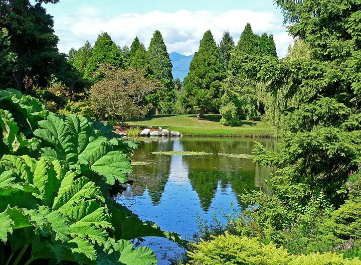
Shaughnessy is mostly residential, with more heritage houses from the early 1900s than most areas. It sits at the city's geographic centre between Queen Elizabeth Park and Arbutus.
Its east side has two hospitals and VanDusen Botanical Garden.
The City data counts 5 Park Board parks here (29.3 hectares in total). The largest are VanDusen Botanical Garden, Kerrisdale Park, Devonshire Park.
- Land area
- About 445 hectares (calculated from the City boundary)
- Housing
- Large heritage houses
- Known for
- Heritage houses, VanDusen Botanical Garden
- SkyTrain stations
- none listed
- Community centres
- None inside the area; residents use Douglas Park, Kerrisdale and Marpole-Oakridge
- Library branches
- None inside the area; nearby Oakridge branch
- Schools in City data
- 4 public, 6 independent
- Dog off-leash parks
- Oak Meadows Park (nearby)
Sources: Shaughnessy, City of Vancouver · City of Vancouver Open Data: Local area boundary · City of Vancouver Open Data: Parks · City of Vancouver Open Data: Community centres · City of Vancouver Open Data: Libraries · City of Vancouver Open Data: Rapid transit stations · City of Vancouver Open Data: Schools
South Cambie
South Cambie, Vancouver, BC
South Cambie lies between Queen Elizabeth Park and Shaughnessy. It is known for medical facilities, including BC Children's Hospital, BC Women's Hospital and GF Strong Rehabilitation Centre.
Douglas Park was set aside as a park in 1926.
The City data counts 5 Park Board parks here (61.1 hectares in total). The largest are Langara Golf Course, Douglas Park, Oak Meadows Park.
- Land area
- About 216 hectares (calculated from the City boundary)
- Housing
- Houses and apartments along Cambie Street
- Known for
- Hospitals, Douglas Park, Cambie Street
- SkyTrain stations
- none listed
- Community centres
- Douglas Park Community Centre
- Library branches
- None inside the area
- Schools in City data
- 7 public, 1 independent
- Dog off-leash parks
- Oak Meadows Park, Heather Park
Sources: South Cambie, City of Vancouver · City of Vancouver Open Data: Local area boundary · City of Vancouver Open Data: Parks · City of Vancouver Open Data: Community centres · City of Vancouver Open Data: Libraries · City of Vancouver Open Data: Rapid transit stations · City of Vancouver Open Data: Schools
Dunbar-Southlands
Dunbar-Southlands, Vancouver, BC
Dunbar-Southlands is in the southwest, north of the Fraser River and east of UBC and Pacific Spirit Regional Park. It has quiet streets with large old trees, the Dunbar Village shopping area and McCleery Golf Course.
It includes Musqueam First Nation land and the semi-rural Southlands area. Archaeology shows people lived in Southlands as early as 400 B.C.
The City data counts 8 Park Board parks here (39.7 hectares in total). The largest are Musqueam Park, Memorial West Park, Balaclava Park.
- Land area
- About 902 hectares (calculated from the City boundary)
- Housing
- Mostly detached houses; semi-rural Southlands
- Known for
- Dunbar Village, McCleery Golf Course, Musqueam lands
- SkyTrain stations
- none listed
- Community centres
- Dunbar
- Library branches
- Dunbar
- Schools in City data
- 6 public, 2 independent
- Dog off-leash parks
- Balaclava Park, Musqueam Park, Valdez Park
Sources: Dunbar-Southlands, City of Vancouver · City of Vancouver Open Data: Local area boundary · City of Vancouver Open Data: Parks · City of Vancouver Open Data: Community centres · City of Vancouver Open Data: Libraries · City of Vancouver Open Data: Rapid transit stations · City of Vancouver Open Data: Schools
Kerrisdale
Kerrisdale, Vancouver, BC
Kerrisdale is a mostly residential area in the southwest, sloping down to the Fraser River, with many long-time residents and large street trees. Kerrisdale Village is the main shopping area.
The McCleery brothers farmed here from 1867, where McCleery Golf Course is now.
The City data counts 9 Park Board parks here (69 hectares in total). The largest are McCleery Golf Course, Fraser River Park, Maple Grove Park.
- Land area
- About 656 hectares (calculated from the City boundary)
- Housing
- Mostly houses, some apartments near the village
- Known for
- Kerrisdale Village, McCleery Golf Course, Arbutus Greenway
- SkyTrain stations
- none listed
- Community centres
- Kerrisdale Community Centre, Kerrisdale Cyclone Taylor Arena, Kerrisdale Pool
- Library branches
- Kerrisdale
- Schools in City data
- 4 public, 1 independent
- Dog off-leash parks
- Fraser River Park
Sources: Kerrisdale, City of Vancouver · City of Vancouver Open Data: Local area boundary · City of Vancouver Open Data: Parks · City of Vancouver Open Data: Community centres · City of Vancouver Open Data: Libraries · City of Vancouver Open Data: Rapid transit stations · City of Vancouver Open Data: Schools
Sources: Areas of the city, City of Vancouver · Kitsilano, City of Vancouver · Fairview, City of Vancouver · West Point Grey, City of Vancouver · Arbutus Ridge, City of Vancouver · Shaughnessy, City of Vancouver · South Cambie, City of Vancouver · Dunbar-Southlands, City of Vancouver · Kerrisdale, City of Vancouver
East side neighbourhoods
East Vancouver runs from the old neighbourhoods next to downtown east to Boundary Road and Burnaby. The Expo and Millennium SkyTrain lines cross it.
Strathcona
Strathcona, Vancouver, BC
Strathcona is one of Vancouver's oldest neighbourhoods, with restored row houses, gardens and front porches. It grew from the buildings around the old Hastings Mill.
It has houses, apartment buildings and rooming houses, and the City lists Dr. Sun Yat-Sen Classical Chinese Garden among its local facilities.
The City data counts 6 Park Board parks here (17.1 hectares in total). The largest are Strathcona Park, Trillium Park, Thornton Park.
- Land area
- About 434 hectares (calculated from the City boundary)
- Housing
- Older houses, apartments and rooming houses
- Known for
- Heritage homes, Strathcona Park, Chinatown edge
- SkyTrain stations
- VCC - Clark
- Community centres
- Evelyne Saller Centre, Strathcona, Ray-Cam Co-Operative Center
- Library branches
- Strathcona
- Schools in City data
- 2 public, 1 independent
- Dog off-leash parks
- Strathcona Park
Sources: Strathcona, City of Vancouver · City of Vancouver Open Data: Local area boundary · City of Vancouver Open Data: Parks · City of Vancouver Open Data: Community centres · City of Vancouver Open Data: Libraries · City of Vancouver Open Data: Rapid transit stations · City of Vancouver Open Data: Schools
Mount Pleasant
Mount Pleasant, Vancouver, BC
Mount Pleasant runs from False Creek up the slope to where Broadway, Kingsway and Main Street meet. The City describes it as known for unusual stores, heritage buildings and arts festivals, and popular with first-time buyers and families.
By 1904 it had a tannery, breweries and a train station, and it later got Vancouver's first skyscraper, the Lee Building.
The City data counts 13 Park Board parks here (11.6 hectares in total). The largest are China Creek North Park, Robson Park, China Creek South Park.
- Land area
- About 369 hectares (calculated from the City boundary)
- Housing
- Mix of apartments, older houses and new condos
- Known for
- Main Street shops, Broadway and Kingsway junction, City Hall nearby
- SkyTrain stations
- Broadway - City Hall
- Community centres
- Creekside, Mount Pleasant
- Library branches
- Mount Pleasant
- Schools in City data
- 3 public, 3 independent
- Dog off-leash parks
- Hinge Park
Sources: Mount Pleasant, City of Vancouver · City of Vancouver Open Data: Local area boundary · City of Vancouver Open Data: Parks · City of Vancouver Open Data: Community centres · City of Vancouver Open Data: Libraries · City of Vancouver Open Data: Rapid transit stations · City of Vancouver Open Data: Schools
Grandview-Woodland
Grandview-Woodland, Vancouver, BC
Grandview-Woodland is in the northeast of the city, east of Chinatown and Strathcona and west of Hastings Park. Commercial Drive, called The Drive, is its main street.
It reaches south to Trout Lake. The City is renewing the Britannia Community Services Centre site.
The City data counts 14 Park Board parks here (10.9 hectares in total). The largest are Templeton Park, Pandora Park, McSpadden Park.
- Land area
- About 472 hectares (calculated from the City boundary)
- Housing
- Mix of older houses, apartments and some industry
- Known for
- Commercial Drive, Britannia Community Centre
- SkyTrain stations
- Commercial - Broadway
- Community centres
- Britannia Community Centre, Britannia Ice Rink, Britannia Pool, Templeton Park Pool
- Library branches
- Britannia
- Schools in City data
- 7 public, 1 independent
- Dog off-leash parks
- Pandora Park
Sources: Grandview-Woodland, City of Vancouver · City of Vancouver Open Data: Local area boundary · City of Vancouver Open Data: Parks · City of Vancouver Open Data: Community centres · City of Vancouver Open Data: Libraries · City of Vancouver Open Data: Rapid transit stations · City of Vancouver Open Data: Schools
Hastings-Sunrise
Hastings-Sunrise, Vancouver, BC
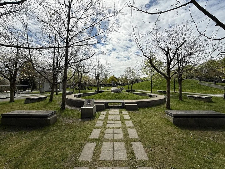
Hastings-Sunrise is best known as the home of the Pacific National Exhibition at Hastings Park. It is mainly residential, with shops along East Hastings Street, and borders Burnaby at Boundary Road.
A small resort called New Brighton grew up on the shore near today's New Brighton Park.
The City data counts 16 Park Board parks here (114 hectares in total). The largest are Hastings Park, Rupert Park, New Brighton Park.
- Land area
- About 827 hectares (calculated from the City boundary)
- Housing
- Mostly houses and low-rise apartments
- Known for
- Hastings Park and the PNE, East Hastings shops, North Shore views
- SkyTrain stations
- none listed
- Community centres
- Hastings Community Centre, Thunderbird Community Centre, New Brighton Pool
- Library branches
- Hastings
- Schools in City data
- 10 public, 4 independent
- Dog off-leash parks
- Sunrise Park, New Brighton Park, Dusty Greenwell Park, Burrard View Park
Sources: Hastings-Sunrise, City of Vancouver · City of Vancouver Open Data: Local area boundary · City of Vancouver Open Data: Parks · City of Vancouver Open Data: Community centres · City of Vancouver Open Data: Libraries · City of Vancouver Open Data: Rapid transit stations · City of Vancouver Open Data: Schools
Kensington-Cedar Cottage
Kensington-Cedar Cottage, Vancouver, BC
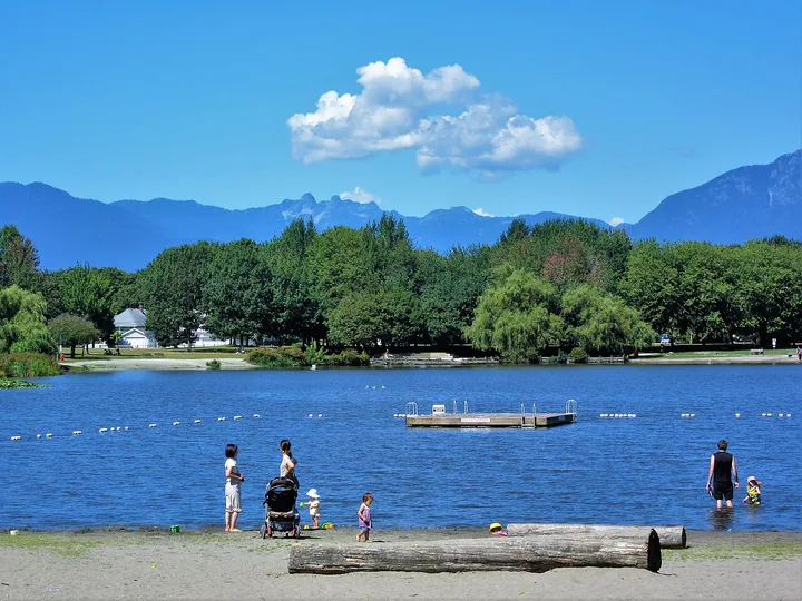
Kensington-Cedar Cottage is in the centre of East Vancouver, running down to Trout Lake. The City notes its wide mix of cultures and its artists working in live/work studios.
It joins two older areas: Cedar Cottage north of Kingsway and Kensington south of Kingsway to 41st Avenue.
The City data counts 11 Park Board parks here (48.9 hectares in total). The largest are John Hendry (Trout Lake) Park, Kensington Park, Clark Park.
- Land area
- About 720 hectares (calculated from the City boundary)
- Housing
- Mostly houses, some apartments
- Known for
- Trout Lake, Kingsway, live/work studios
- SkyTrain stations
- Commercial - Broadway
- Community centres
- Kensington Community Centre, Kensington Pool, Trout Lake Community Centre, Trout Lake Ice Rink
- Library branches
- Kensington
- Schools in City data
- 12 public, 2 independent
- Dog off-leash parks
- John Hendry (Trout Lake) Park, Kingcrest Park, General Brock Park, Jones Park
Sources: Kensington-Cedar Cottage, City of Vancouver · City of Vancouver Open Data: Local area boundary · City of Vancouver Open Data: Parks · City of Vancouver Open Data: Community centres · City of Vancouver Open Data: Libraries · City of Vancouver Open Data: Rapid transit stations · City of Vancouver Open Data: Schools
Renfrew-Collingwood
Renfrew-Collingwood, Vancouver, BC
Renfrew-Collingwood runs along the city's east boundary with Burnaby. It is mainly residential, with shops along the Collingwood stretch of Kingsway.
Renfrew Ravine Park follows a natural creek in the Still Creek watershed.
The City data counts 15 Park Board parks here (37.2 hectares in total). The largest are Falaise Park, Renfrew Ravine Park, Renfrew Community Park.
- Land area
- About 804 hectares (calculated from the City boundary)
- Housing
- Mostly houses, with towers near Joyce-Collingwood
- Known for
- Renfrew Ravine, Kingsway shops, five SkyTrain stations
- SkyTrain stations
- 29th Avenue, Joyce - Collingwood, Nanaimo, Renfrew, Rupert
- Community centres
- Renfrew Park Community Centre, Renfrew Pool
- Library branches
- Renfrew, Collingwood
- Schools in City data
- 13 public, 6 independent
- Dog off-leash parks
- Falaise Park, Renfrew Community Park
Sources: Renfrew-Collingwood, City of Vancouver · City of Vancouver Open Data: Local area boundary · City of Vancouver Open Data: Parks · City of Vancouver Open Data: Community centres · City of Vancouver Open Data: Libraries · City of Vancouver Open Data: Rapid transit stations · City of Vancouver Open Data: Schools
Riley Park
Riley Park, Vancouver, BC
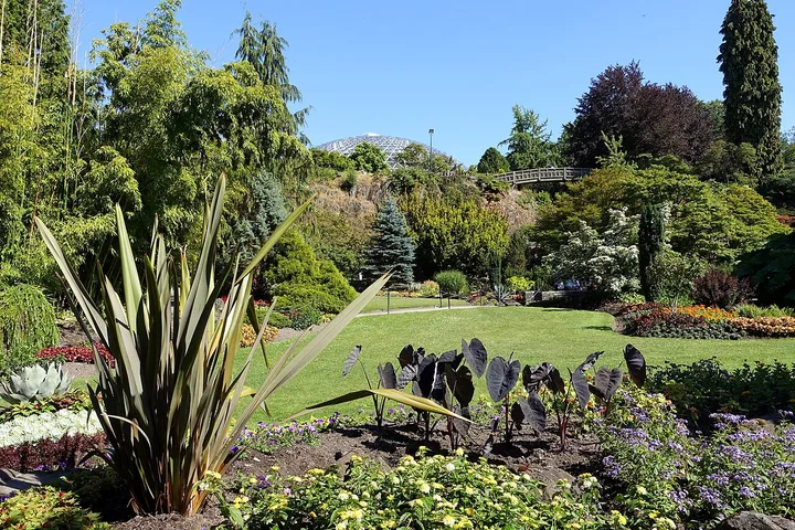
Riley Park runs from Kingsway south past City Hall to Queen Elizabeth Park on Little Mountain. It has shopping along Main Street and Cambie Street, Nat Bailey Stadium and the Vancouver Olympic/Paralympic Centre (Hillcrest).
Little Mountain was quarried for rock, and one quarry became the sunken garden in Queen Elizabeth Park.
The City data counts 7 Park Board parks here (71.2 hectares in total). The largest are Queen Elizabeth Park, Hillcrest Park, Nat Bailey Stadium.
- Land area
- About 490 hectares (calculated from the City boundary)
- Housing
- Mostly houses, apartments on Cambie and Main
- Known for
- Queen Elizabeth Park, Nat Bailey Stadium, Hillcrest Centre, Main Street
- SkyTrain stations
- King Edward
- Community centres
- Hillcrest Community Centre, Hillcrest Aquatic Centre, Hillcrest Ice Rink
- Library branches
- Terry Salman
- Schools in City data
- 4 public, 0 independent
- Dog off-leash parks
- Queen Elizabeth Park, Nat Bailey Stadium (temporarily closed)
Sources: Riley Park, City of Vancouver · City of Vancouver Open Data: Local area boundary · City of Vancouver Open Data: Parks · City of Vancouver Open Data: Community centres · City of Vancouver Open Data: Libraries · City of Vancouver Open Data: Rapid transit stations · City of Vancouver Open Data: Schools
Sources: Areas of the city, City of Vancouver · Strathcona, City of Vancouver · Mount Pleasant, City of Vancouver · Grandview-Woodland, City of Vancouver · Hastings-Sunrise, City of Vancouver · Kensington-Cedar Cottage, City of Vancouver · Renfrew-Collingwood, City of Vancouver · Riley Park, City of Vancouver
South Vancouver neighbourhoods
South Vancouver slopes down to the Fraser River. Much of it was the separate District of South Vancouver until it joined the City in 1929.
Oakridge
Oakridge, Vancouver, BC
Oakridge in south-central Vancouver mixes residential streets, a large shopping centre and Langara College. The City notes it is a hub for Vancouver's Jewish community.
It stayed mostly undeveloped until the CPR built on its land in the early 1950s.
The City data counts 5 Park Board parks here (14 hectares in total). The largest are Tisdall Park, Montgomery Park, Columbia Park.
- Land area
- About 399 hectares (calculated from the City boundary)
- Housing
- Houses, with towers growing around Oakridge Centre
- Known for
- Oakridge Centre, Langara College, Langara Golf Course nearby
- SkyTrain stations
- Langara - 49th Avenue, Oakridge - 41st Avenue
- Community centres
- None inside the area; Marpole-Oakridge Community Centre is nearby
- Library branches
- Oakridge
- Schools in City data
- 4 public, 3 independent
- Dog off-leash parks
- None now; a fenced area is planned in the new Oakridge Park
Sources: Oakridge, City of Vancouver · City of Vancouver Open Data: Local area boundary · City of Vancouver Open Data: Parks · City of Vancouver Open Data: Community centres · City of Vancouver Open Data: Libraries · City of Vancouver Open Data: Rapid transit stations · City of Vancouver Open Data: Schools
Marpole
Marpole, Vancouver, BC
Marpole is the city's gateway from the south and the airport, with three bridges and a SkyTrain line over the Fraser River. It has low-rise apartments, houses and shopping on Granville Street.
People are believed to have lived here as far back as 3500 B.C., and archaeologists have documented early village sites on the river.
The City data counts 11 Park Board parks here (17.2 hectares in total). The largest are Winona Park, Oak Park, Riverview Park.
- Land area
- About 596 hectares (calculated from the City boundary)
- Housing
- Low-rise apartments and houses
- Known for
- Granville Street shops, Fraser River bridges, Canada Line
- SkyTrain stations
- Marine Drive
- Community centres
- Marpole-Oakridge
- Library branches
- Marpole
- Schools in City data
- 4 public, 4 independent
- Dog off-leash parks
- Fraser River Park (nearby, in Kerrisdale)
Sources: Marpole, City of Vancouver · City of Vancouver Open Data: Local area boundary · City of Vancouver Open Data: Parks · City of Vancouver Open Data: Community centres · City of Vancouver Open Data: Libraries · City of Vancouver Open Data: Rapid transit stations · City of Vancouver Open Data: Schools
Sunset
Sunset, Vancouver, BC
Sunset in south-central Vancouver slopes from Mountain View Cemetery to the Fraser River. The City describes it as diverse, with single-family homes, low-rise apartments and many independent shops on Main and Fraser streets.
It is a hub of Vancouver's Indo-Canadian community.
The City data counts 6 Park Board parks here (24.6 hectares in total). The largest are Memorial South Park, Moberly Park, Sunset Park.
- Land area
- About 653 hectares (calculated from the City boundary)
- Housing
- Single-family homes and low-rise apartments
- Known for
- Main Street and Fraser Street shops, Memorial South Park
- SkyTrain stations
- none listed
- Community centres
- Sunset Community Centre, Sunset Ice Rink
- Library branches
- South Hill
- Schools in City data
- 6 public, 1 independent
- Dog off-leash parks
- Sunset Park, George Park
Sources: Sunset, City of Vancouver · City of Vancouver Open Data: Local area boundary · City of Vancouver Open Data: Parks · City of Vancouver Open Data: Community centres · City of Vancouver Open Data: Libraries · City of Vancouver Open Data: Rapid transit stations · City of Vancouver Open Data: Schools
Victoria-Fraserview
Victoria-Fraserview, Vancouver, BC
Victoria-Fraserview sits on the south slope to the Fraser River between the Knight Street Bridge and Killarney. The City notes its large Indo-Canadian population and shops selling produce, fabrics and international food.
It was part of the Municipality of South Vancouver from 1892 until 1929.
The City data counts 7 Park Board parks here (18.1 hectares in total). The largest are Gordon Park, Bobolink Park, Nanaimo Park.
- Land area
- About 546 hectares (calculated from the City boundary)
- Housing
- Mostly houses, some apartments
- Known for
- Fraser Street and Victoria Drive shops, Fraserview Golf Course nearby
- SkyTrain stations
- none listed
- Community centres
- None inside the area; Killarney Community Centre is nearby
- Library branches
- Fraserview branch (South Hill branch nearby)
- Schools in City data
- 8 public, 1 independent
- Dog off-leash parks
- Tecumseh Park
Sources: Victoria-Fraserview, City of Vancouver · City of Vancouver Open Data: Local area boundary · City of Vancouver Open Data: Parks · City of Vancouver Open Data: Community centres · City of Vancouver Open Data: Libraries · City of Vancouver Open Data: Rapid transit stations · City of Vancouver Open Data: Schools
Killarney
Killarney, Vancouver, BC
Killarney is in the southeast corner of the city, bordering Burnaby and the Fraser River. It is mostly single-family houses with some multi-family homes and high-rises in the Fraserlands by the river.
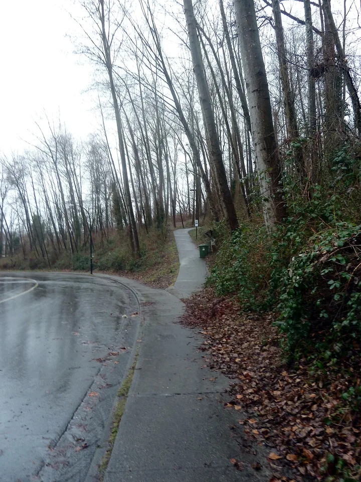
Everett Crowley Park has about 40 hectares of trails and an off-leash area.
The City data counts 9 Park Board parks here (159.3 hectares in total). The largest are Fraserview Golf Course, Everett Crowley Park, Killarney Park.
- Land area
- About 688 hectares (calculated from the City boundary)
- Housing
- Mostly houses; towers in the Fraserlands
- Known for
- Everett Crowley Park, Champlain Heights, Fraserview Golf Course
- SkyTrain stations
- none listed
- Community centres
- Killarney Community Centre, Killarney Pool, Killarney Ice Rink, Champlain Heights Community Centre
- Library branches
- Champlain Heights
- Schools in City data
- 6 public, 0 independent
- Dog off-leash parks
- Killarney Park, Sparwood Park, Everett Crowley Park, Fraserview Golf Course
Sources: Killarney, City of Vancouver · City of Vancouver Open Data: Local area boundary · City of Vancouver Open Data: Parks · City of Vancouver Open Data: Community centres · City of Vancouver Open Data: Libraries · City of Vancouver Open Data: Rapid transit stations · City of Vancouver Open Data: Schools
Sources: Areas of the city, City of Vancouver · Oakridge, City of Vancouver · Marpole, City of Vancouver · Sunset, City of Vancouver · Victoria-Fraserview, City of Vancouver · Killarney, City of Vancouver
Community centres, libraries and schools across the city
The City open data lists 27 community centres and 22 Vancouver Public Library locations (including the Central Library and Outreach Services). Arbutus Ridge, Oakridge, Shaughnessy and Victoria-Fraserview have no community centre inside their boundaries in that data, so residents use centres in nearby areas such as Kerrisdale, Dunbar, Marpole-Oakridge and Killarney.
The City schools dataset lists 121 public schools, 54 independent schools and 19 StrongStart BC centres. To find your catchment school, use the Vancouver School Board school locator.
Sources: City of Vancouver Open Data: Community centres · City of Vancouver Open Data: Libraries · City of Vancouver Open Data: Schools
What this guide does not cover
Population and income figures are not shown. The newest local area census profile in City open data is from 2016, and the City's 2021 local area figures were described as estimates. Each City local area page links a community statistics PDF if you need those numbers.
The rapid transit station data does not yet include the Broadway Subway stations under construction. This guide makes no claims about crime or which area is "best"; it describes each area with City facts.
Sources: City of Vancouver Open Data: Census local area profiles 2016 · City of Vancouver Open Data: Rapid transit stations · 2021 Census population and dwelling counts memo, City of Vancouver
10 questions about Vancouver neighbourhoods
How many neighbourhoods does Vancouver have?
The City of Vancouver divides the city into 22 local areas for planning and services. It also lists many smaller named communities, such as Yaletown, Gastown and Commercial Drive, inside them.
Are the 22 local areas the only neighbourhood names?
No. The City says people disagree on some names and boundaries. Places like Chinatown, Gastown, Coal Harbour and Yaletown are inside the Downtown and Strathcona local areas.
Which Vancouver neighbourhood is the largest by land area?
Dunbar-Southlands, at about 902 hectares based on the City boundary data. South Cambie is the smallest at about 216 hectares.
Which neighbourhood has the most SkyTrain stations?
Downtown, with Waterfront, Burrard, Granville, Vancouver City Centre, Yaletown-Roundhouse, Stadium-Chinatown and Main Street-Science World in the City station data. Renfrew-Collingwood has five Expo and Millennium Line stations.
Is Stanley Park part of a neighbourhood?
Stanley Park is outside all 22 local area boundaries in the City boundary data. The parks dataset groups it with the West End, which borders it.
Which neighbourhood has the most parkland?
Killarney has about 159 hectares of Park Board land, including Fraserview Golf Course and Everett Crowley Park. If Stanley Park is counted with the West End, the West End has the most.
Where is Commercial Drive?
Commercial Drive is in Grandview-Woodland in northeast Vancouver. The City describes it as a mix of old-world charm and modern style, and one of the city's organic-food hubs.
Which neighbourhoods are near the Fraser River?
Dunbar-Southlands, Kerrisdale, Marpole, Sunset, Victoria-Fraserview and Killarney all slope down to the Fraser River on the south edge of the city.
Where can I find census numbers for each neighbourhood?
Each City local area page links a community statistics PDF, and the City open data portal has local area census profiles for 2001 to 2016. The 2016 profile is the newest one in open data.
Source: City of Vancouver Open Data: Census local area profiles 2016
How many schools are in Vancouver?
The City schools dataset lists 194 entries: 121 public schools, 54 independent schools and 19 StrongStart BC early learning centres.
Official neighbourhood information
- Areas of the city, City of Vancouver
- City of Vancouver Open Data: Local area boundary
- City of Vancouver Open Data: Census local area profiles 2016
Sources: Areas of the city, City of Vancouver