Checked
Vancouver's largest parks: every park of 10 hectares or more
Vancouver, British Columbia, Canada
All 19 Vancouver Park Board parks of 10 hectares or more, from Stanley Park to New Brighton Park, with sizes, facilities, winter hours and walking notes for Vancouver, British Columbia.
Key information
Nineteen Vancouver Park Board parks are 10 hectares or larger. Stanley Park is by far the biggest at 400 hectares. For a long walk, the best choices are Stanley Park and the seawall, Queen Elizabeth Park, Hastings Park, Everett Crowley Park and the beach parks at Jericho and Locarno. Three of the 19 are golf courses and VanDusen is a paid garden.
On this page
Every Vancouver park of 10 hectares or more
| Park | Hectares | Neighbourhood | Type | Dog off-leash area |
|---|---|---|---|---|
| Stanley Park | 400 | West End | Park | Yes |
| Fraserview Golf Course | 84.34 | Killarney | Golf course | Yes |
| Hastings Park | 62 | Hastings-Sunrise | Park | No |
| Queen Elizabeth Park | 52.98 | Riley Park | Park | Yes |
| Langara Golf Course | 48.57 | South Cambie | Golf course | No |
| McCleery Golf Course | 48.57 | Kerrisdale | Golf course | No |
| Jericho Beach Park | 46.71 | West Point Grey | Park | No |
| Everett Crowley Park | 38.08 | Killarney | Park | Yes |
| John Hendry (Trout Lake) Park | 27.31 | Kensington-Cedar Cottage | Park | Yes |
| VanDusen Botanical Garden | 22.29 | Shaughnessy | Paid garden | No |
| Musqueam Park | 22.05 | Dunbar-Southlands | Park | Yes |
| Locarno Park | 19 | West Point Grey | Park | Yes |
| Vanier Park | 16.95 | Kitsilano | Park | No |
| Memorial South Park | 13.59 | Sunset | Park | No |
| Kitsilano Beach Park | 13.47 | Kitsilano | Park | No |
| Killarney Park | 13.36 | Killarney | Park | Yes |
| Rupert Park | 11.43 | Hastings-Sunrise | Park | No |
| Strathcona Park | 10.07 | Strathcona | Park | Yes |
| New Brighton Park | 10 | Hastings-Sunrise | Park | Yes |
The City of Vancouver Parks open dataset lists 218 Park Board parks. 19 of them cover 10 hectares or more. Sizes are the dataset figures and include water, buildings and golf greens.
Sources: City of Vancouver Open Data: Parks · City of Vancouver Open Data: Parks facilities
How the biggest parks compare
- Stanley Park400 hectares
- Fraserview Golf Course84.34 hectares
- Hastings Park62 hectares
- Queen Elizabeth Park52.98 hectares
- Langara Golf Course48.57 hectares
- McCleery Golf Course48.57 hectares
- Jericho Beach Park46.71 hectares
- Everett Crowley Park38.08 hectares
- John Hendry (Trout Lake) Park27.31 hectares
- VanDusen Botanical Garden22.29 hectares
Sources: City of Vancouver Open Data: Parks
Which big parks are best for a long walk?
These large parks are open green space you can walk through freely: Stanley Park, Hastings Park, Queen Elizabeth Park, Jericho Beach Park, Everett Crowley Park, John Hendry (Trout Lake) Park, Musqueam Park, Locarno Park, Vanier Park, Kitsilano Beach Park, New Brighton Park.
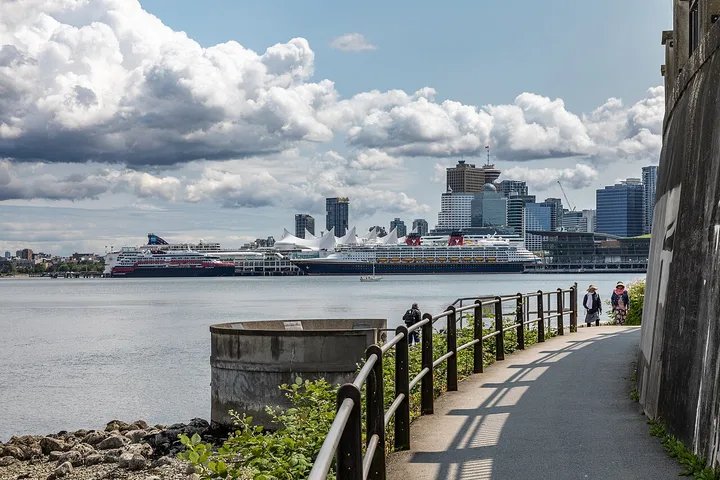
The seaside path is the longest walk. The City says it runs 28 km from the Vancouver Convention Centre to Spanish Banks Park, and the 9 km loop around Stanley Park takes 2 to 3 hours on foot. Walkers and cyclists use separate marked lanes.
Fraserview, Langara and McCleery are golf courses. Their fairways are for golfers, so use them only where paths or off-leash edges are marked.
Sources: Seawall in Vancouver, City of Vancouver · City of Vancouver Open Data: Parks
Visiting big parks in winter
- Stanley Park and Hastings Park are open 6am to 10pm unless posted. Stanley Park washrooms are open dawn to dusk.
- The seawall between Prospect Point and Third Beach closes for about 3 weeks each winter for rock scaling. The City says intermittent closures may happen in spring 2027.
- VanDusen Botanical Garden is open 10am to 2pm in November and December, closed December 25. Its Festival of Lights is a separate ticketed event.
- Lifeguards only work at city beaches from Victoria Day to Labour Day.
Sources: Stanley Park, City of Vancouver · Seawall in Vancouver, City of Vancouver · Hastings Park, City of Vancouver · VanDusen Botanical Garden, City of Vancouver · Beaches, City of Vancouver
What this list includes and leaves out
This list covers Vancouver Park Board parks in the City Parks dataset. It does not include Pacific Spirit Regional Park, which is a Metro Vancouver regional park, or the University of British Columbia lands, which are outside the City.
The Park Board website says it maintains more than 250 parks, while the open dataset lists 218. Our full Vancouver parks directory lists all 218 records.
Sources: City of Vancouver Open Data: Parks · Parks, gardens, and beaches, City of Vancouver
The 19 largest parks, one by one
Stanley Park
2000 W Georgia Street, Vancouver, BC
Stanley Park covers 400 hectares in West End, near W Georgia Street and Chilco Street, according to the City parks dataset.
The City calls Stanley Park Vancouver's first and largest urban park. The 9 km seawall loop around it takes 2 to 3 hours to walk or about 1 hour to cycle.
The park is open 6am to 10pm unless posted, and washrooms are open dawn to dusk. Each winter the Park Board closes the seawall between Prospect Point and Third Beach for about 3 weeks for rock scaling. The section between Lumberman's Arch and Third Beach reopened November 13, 2026, and the City says intermittent closures may happen in spring 2027.
- Size
- 400 hectares
- Neighbourhood
- West End
- Washrooms
- Yes
- Facilities in city data
- Picnic Sites: 4; Dogs Off-Leash Areas: 1; Golf Courses: 1; Field Houses: 3; Lighted Fields: 1; Swimming Pools: 1; Water/Spray Parks: 1; Running Tracks: 1; Cricket Pitches: 2; Rugby Fields: 2; Restaurants: 4; Food Concessions: 7; Bowling Greens: 2; Playgrounds: 4; Softball: 2; Tennis Courts: 21; Jogging Trails: 3
Sources: City of Vancouver Open Data: Parks · City of Vancouver Open Data: Parks facilities · Stanley Park, City of Vancouver · Seawall in Vancouver, City of Vancouver
Fraserview Golf Course
7800 Vivian Drive, Vancouver, BC
Fraserview Golf Course covers 84.34 hectares in Killarney, near E 54th Avenue and Vivian Drive, according to the City parks dataset.
A public Park Board golf course with tree-lined fairways overlooking the Fraser River. The course and shop are open dawn to dusk. It is a golf course, not an open walking park, but the City lists two dog off-leash areas along its edges at Rosemont Drive, E 57th Avenue and Vivian Drive.
- Size
- 84.34 hectares
- Neighbourhood
- Killarney
- Washrooms
- Yes
- Facilities in city data
- Restaurants: 1; Golf Courses: 1; Jogging Trails: 1; Dogs Off-Leash Areas: 1
Sources: City of Vancouver Open Data: Parks · City of Vancouver Open Data: Parks facilities · Fraserview Golf Course, City of Vancouver · Dog off-leash areas, City of Vancouver
Hastings Park
2901 E Hastings, Vancouver, BC
Hastings Park covers 62 hectares in Hastings-Sunrise, near E Hastings Street and Renfrew Street, according to the City parks dataset.
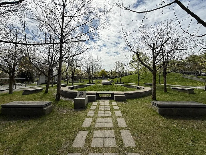
The City calls Hastings Park one of Vancouver's largest urban parks. It is open 6am to 10pm with no admission. It has the Empire Fields track (560 metres) and turf fields, Plateau Sports Park (basketball, parkour, bike skills park and a playground) and walking and cycling greenways. Playland and Hastings Racecourse are separate attractions on the site.
- Size
- 62 hectares
- Neighbourhood
- Hastings-Sunrise
- Washrooms
- Yes
- Facilities in city data
- Skateboard Parks: 1; Basketball Courts: 1
Sources: City of Vancouver Open Data: Parks · City of Vancouver Open Data: Parks facilities · Hastings Park, City of Vancouver
Queen Elizabeth Park
4600 Cambie Street, Vancouver, BC
Queen Elizabeth Park covers 52.98 hectares in Riley Park, near W 29th Avenue and Cambie Street, according to the City parks dataset.
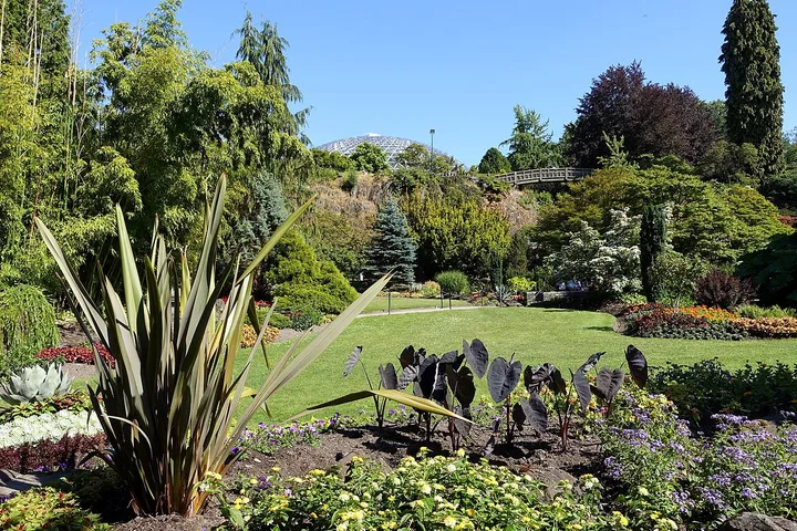
At 125 metres above sea level, Queen Elizabeth Park is the highest point in Vancouver. The City describes it as a 52-hectare park with the Bloedel Conservatory, a quarry garden, an arboretum, tennis, lawn bowling and pitch and putt. It also has a dog off-leash area off E 37th Avenue.
- Size
- 52.98 hectares
- Neighbourhood
- Riley Park
- Washrooms
- Yes
- Facilities in city data
- Field Houses: 1; Tennis Courts: 17; Dogs Off-Leash Areas: 1; Restaurants: 1; Bowling Greens: 1; Golf Courses: 1; Basketball Courts: 4; Outdoor Roller Hockey Rinks: 2; Ball Hockey: 2; Pickleball: 7; Disc Golf Courses: 1
Sources: City of Vancouver Open Data: Parks · City of Vancouver Open Data: Parks facilities · Queen Elizabeth Park, City of Vancouver · Dog off-leash areas, City of Vancouver
Langara Golf Course
6706 Alberta Street, Vancouver, BC
Langara Golf Course covers 48.57 hectares in South Cambie, near W 49th Avenue and Alberta Street, according to the City parks dataset.
A Park Board golf course built in 1926 by the Canadian Pacific Railway. It is a par 71 course, open dawn to dusk. It is not an open walking park.
- Size
- 48.57 hectares
- Neighbourhood
- South Cambie
- Washrooms
- Not listed
- Facilities in city data
- Golf Courses: 1; Tennis Courts: 4; Playgrounds: 1; Jogging Trails: 1; Restaurants: 1
Sources: City of Vancouver Open Data: Parks · City of Vancouver Open Data: Parks facilities · Langara Golf Course, City of Vancouver
McCleery Golf Course
7188 Macdonald Street, Vancouver, BC
McCleery Golf Course covers 48.57 hectares in Kerrisdale, near W 55th Avenue and MacDonald Street, according to the City parks dataset.
A Park Board golf course and driving range in Kerrisdale with narrow fairways and many water hazards. The course is open dawn to dusk. It is not an open walking park.
- Size
- 48.57 hectares
- Neighbourhood
- Kerrisdale
- Washrooms
- Not listed
- Facilities in city data
- Golf Courses: 1; Restaurants: 1
Sources: City of Vancouver Open Data: Parks · City of Vancouver Open Data: Parks facilities · McCleery Golf Course, City of Vancouver
Jericho Beach Park
3941 Point Grey Road, Vancouver, BC
Jericho Beach Park covers 46.71 hectares in West Point Grey, near Point Grey Road and Wallace Street, according to the City parks dataset.
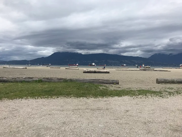
Jericho Beach is on the north side of the park at the west end of Point Grey Road. The east side of the beach is for swimmers and the west side for sailboats and windsurfers. Lifeguards work Victoria Day to Labour Day.
- Size
- 46.71 hectares
- Neighbourhood
- West Point Grey
- Washrooms
- Yes
- Facilities in city data
- Soccer Fields: 3; Softball: 1; Field Hockey: 1; Pickleball: 8; Food Concessions: 1; Picnic Sites: 1; Rugby Fields: 1; Tennis Courts: 4; Beaches: 1; Baseball Diamonds: 1; Ultimate Fields: 1
Sources: City of Vancouver Open Data: Parks · City of Vancouver Open Data: Parks facilities · Jericho Beach, City of Vancouver
Everett Crowley Park
8200 Kerr Street, Vancouver, BC
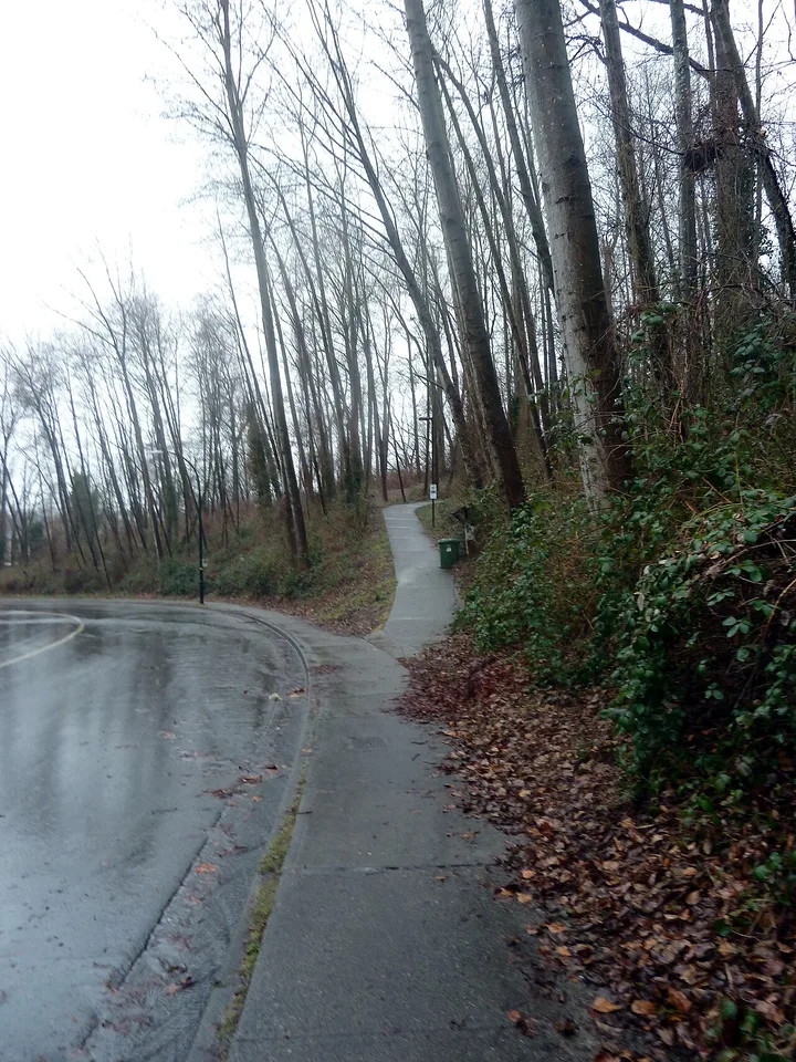
Everett Crowley Park covers 38.08 hectares in Killarney, near SE Marine Drive and Kerr Street, according to the City parks dataset.
A large natural park in Killarney with walking trails. Most of it is a dog off-leash area on specific trails, open 6am to 10pm, but dogs are not allowed near Avalon Pond.
- Size
- 38.08 hectares
- Neighbourhood
- Killarney
- Washrooms
- Not listed
- Facilities in city data
- Dogs Off-Leash Areas: 1
Sources: City of Vancouver Open Data: Parks · City of Vancouver Open Data: Parks facilities · Dog off-leash areas, City of Vancouver · Killarney, City of Vancouver
John Hendry (Trout Lake) Park
3300 Victoria Drive, Vancouver, BC
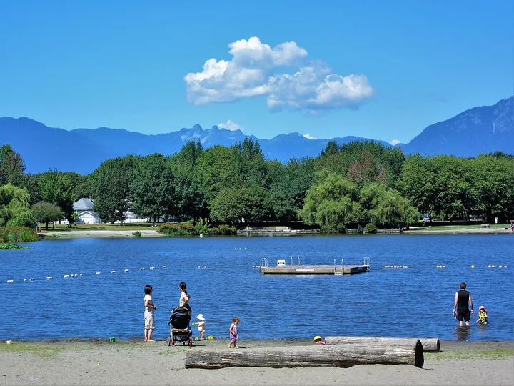
John Hendry (Trout Lake) Park covers 27.31 hectares in Kensington-Cedar Cottage, near E 15th Avenue and Victoria Drive, according to the City parks dataset.
Home to Trout Lake, a freshwater lake with a beach at the south end near Victoria Drive and E 19th Avenue. Swimming is not permitted and there are no lifeguards while a water quality study runs until the end of 2027. The dog off-leash area is at the north end of the lake.
- Size
- 27.31 hectares
- Neighbourhood
- Kensington-Cedar Cottage
- Washrooms
- Yes
- Facilities in city data
- Community Centres: 1; Playgrounds: 2; Softball: 2; Tennis Courts: 3; Rinks: 1; Basketball Courts: 1; Pickleball: 1; Picnic Sites: 1; Jogging Trails: 1; Rugby Fields: 1; Ball Hockey: 1; Baseball Diamonds: 2; Soccer Fields: 2; Field Houses: 1; Lighted Fields: 1; Dogs Off-Leash Areas: 1; Food Concessions: 1
Sources: City of Vancouver Open Data: Parks · City of Vancouver Open Data: Parks facilities · Trout Lake Beach, City of Vancouver · Dog off-leash areas, City of Vancouver
VanDusen Botanical Garden
5251 Oak Street, Vancouver, BC
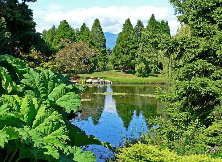
VanDusen Botanical Garden covers 22.29 hectares in Shaughnessy, near W 37th Avenue and Oak Street, according to the City parks dataset.
A paid botanical garden, not a free park. The City describes it as 55 acres with over 7,500 plant species and varieties. November and December hours are 10am to 2pm (closed December 25), with last entry 30 minutes before closing. Pets are not allowed, but service dogs are welcome. Parking on W 37th Avenue is free.
- Size
- 22.29 hectares
- Neighbourhood
- Shaughnessy
- Washrooms
- Yes
- Facilities in city data
- Restaurants: 1
Sources: City of Vancouver Open Data: Parks · City of Vancouver Open Data: Parks facilities · VanDusen Botanical Garden, City of Vancouver
Musqueam Park
4000 SW Marine Drive, Vancouver, BC
Musqueam Park covers 22.05 hectares in Dunbar-Southlands, near SW Marine Drive and Crown Street, according to the City parks dataset.
A large park on SW Marine Drive with soccer fields and a 33,292 square metre dog off-leash area on its edge at Crown Street and W 46th Avenue, open 6am to 10pm.
- Size
- 22.05 hectares
- Neighbourhood
- Dunbar-Southlands
- Washrooms
- Not listed
- Facilities in city data
- Soccer Fields: 2; Dogs Off-Leash Areas: 1
Sources: City of Vancouver Open Data: Parks · City of Vancouver Open Data: Parks facilities · Dog off-leash areas, City of Vancouver
Locarno Park
4445 NW Marine Drive, Vancouver, BC
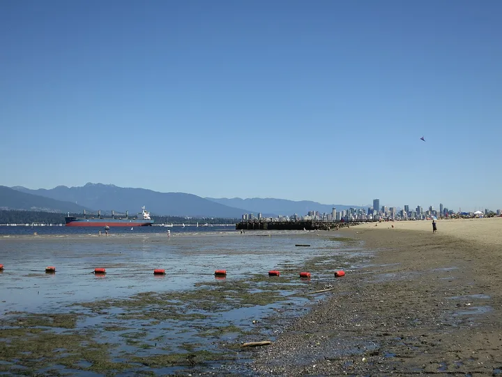
Locarno Park covers 19 hectares in West Point Grey, near NW Marine Drive and Trimble Street, according to the City parks dataset.
Locarno Beach is on the west side of Jericho Park on NW Marine Drive. It is a designated quiet beach, so amplified sound is not permitted. The east half of the park has a dog off-leash area, open 6am to 10pm.
- Size
- 19 hectares
- Neighbourhood
- West Point Grey
- Washrooms
- Yes
- Facilities in city data
- Picnic Sites: 1; Playgrounds: 2; Dogs Off-Leash Areas: 1; Beaches: 1; Food Concessions: 1
Sources: City of Vancouver Open Data: Parks · City of Vancouver Open Data: Parks facilities · Locarno Beach, City of Vancouver · Dog off-leash areas, City of Vancouver
Vanier Park
1000 Chestnut Street, Vancouver, BC
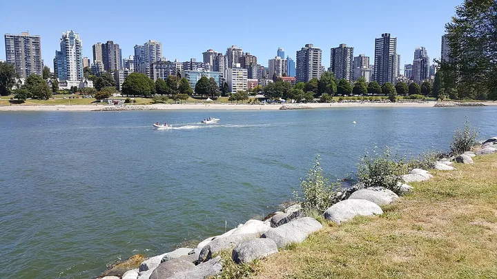
Vanier Park covers 16.95 hectares in Kitsilano, near Whyte Avenue and Chestnut Street, according to the City parks dataset.
A waterfront park in Kitsilano on the seawall, near Burrard Civic Marina. The open data lists a washroom at the marina, open dawn to dusk.
- Size
- 16.95 hectares
- Neighbourhood
- Kitsilano
- Washrooms
- Yes
- Facilities in city data
- None listed
Sources: City of Vancouver Open Data: Parks · City of Vancouver Open Data: Parks facilities · Seawall in Vancouver, City of Vancouver
Memorial South Park
5955 Ross Street, Vancouver, BC
Memorial South Park covers 13.59 hectares in Sunset, near E 41st Avenue and Ross Street, according to the City parks dataset.
- Size
- 13.59 hectares
- Neighbourhood
- Sunset
- Washrooms
- Yes
- Facilities in city data
- Baseball Diamonds: 1; Field Houses: 2; Lighted Fields: 1; Playgrounds: 1; Pickleball: 3; Running Tracks: 1; Ball Hockey: 1; Lacrosse Boxes: 1; Softball: 2; Picnic Sites: 1; Ultimate Fields: 1; Cricket Pitches: 1; Soccer Fields: 4; Tennis Courts: 4; Field Hockey: 1
Sources: City of Vancouver Open Data: Parks · City of Vancouver Open Data: Parks facilities
Kitsilano Beach Park
1499 Arbutus Street, Vancouver, BC
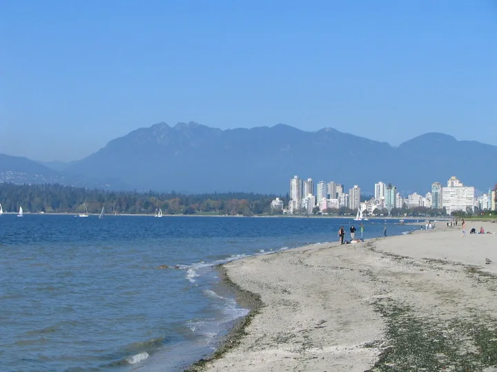
Kitsilano Beach Park covers 13.47 hectares in Kitsilano, near Cornwall Avenue and Arbutus Street, according to the City parks dataset.
Kitsilano Beach is on Cornwall Avenue at the north end of Yew Street. The seawall runs beside the beach and Kitsilano Pool is on the west side. Lifeguards work Victoria Day to Labour Day.
- Size
- 13.47 hectares
- Neighbourhood
- Kitsilano
- Washrooms
- Yes
- Facilities in city data
- Playgrounds: 1; Restaurants: 1; Water/Spray Parks: 1; Tennis Courts: 10; Basketball Courts: 2; Swimming Pools: 1; Beaches: 1; Food Concessions: 1
Sources: City of Vancouver Open Data: Parks · City of Vancouver Open Data: Parks facilities · Kitsilano Beach, City of Vancouver
Killarney Park
6205 Kerr Street, Vancouver, BC
Killarney Park covers 13.36 hectares in Killarney, near Waverley Street and Kerr Street, according to the City parks dataset.
A sports park beside Killarney Community Centre with fields, a pool, a rink and a dog off-leash area. Part of the off-leash area is temporarily a sport field during FIFA training site and track renewal work.
- Size
- 13.36 hectares
- Neighbourhood
- Killarney
- Washrooms
- Not listed
- Facilities in city data
- Swimming Pools: 1; Field Houses: 1; Softball: 1; Playgrounds: 2; Lighted Fields: 2; Rinks: 1; Running Tracks: 1; Wading Pool: 1; Ultimate Fields: 1; Baseball Diamonds: 3; Community Halls: 1; Community Centres: 1; Soccer Fields: 3; Dogs Off-Leash Areas: 1
Sources: City of Vancouver Open Data: Parks · City of Vancouver Open Data: Parks facilities · Dog off-leash areas, City of Vancouver
Rupert Park
1600 Rupert Street, Vancouver, BC
Rupert Park covers 11.43 hectares in Hastings-Sunrise, near E 1st Avenue and Rupert Street, according to the City parks dataset.
- Size
- 11.43 hectares
- Neighbourhood
- Hastings-Sunrise
- Washrooms
- Yes
- Facilities in city data
- Golf Courses: 1; Pickleball: 4; Soccer Fields: 1; Tennis Courts: 4; Rugby Fields: 1; Softball: 1; Field Houses: 1; Football Fields: 1; Playgrounds: 1
Sources: City of Vancouver Open Data: Parks · City of Vancouver Open Data: Parks facilities
Strathcona Park
857 Malkin Avenue, Vancouver, BC
Strathcona Park covers 10.07 hectares in Strathcona, near Malkin Avenue and Hawks Avenue, according to the City parks dataset.
A sports park in Strathcona with fields, a skateboard park, a track and a dog off-leash area in the northeast corner, open 5am to 10am and 5pm to 10pm.
- Size
- 10.07 hectares
- Neighbourhood
- Strathcona
- Washrooms
- Yes
- Facilities in city data
- Skateboard Parks: 1; Playgrounds: 1; Basketball Courts: 1; Running Tracks: 1; Field Houses: 1; Softball: 2; Tennis Courts: 4; Baseball Diamonds: 1; Soccer Fields: 4; Dogs Off-Leash Areas: 1
Sources: City of Vancouver Open Data: Parks · City of Vancouver Open Data: Parks facilities · Dog off-leash areas, City of Vancouver
New Brighton Park
3201 New Brighton Road, Vancouver, BC
New Brighton Park covers 10 hectares in Hastings-Sunrise, near New Brighton Road and N Windermere Street, according to the City parks dataset.
A waterfront park on Burrard Inlet with an outdoor pool, picnic site and a fenced dog off-leash area. Its beach is open to dogs from October to April.
- Size
- 10 hectares
- Neighbourhood
- Hastings-Sunrise
- Washrooms
- Yes
- Facilities in city data
- Field Houses: 1; Soccer Fields: 1; Food Concessions: 1; Playgrounds: 2; Dogs Off-Leash Areas: 1; Picnic Sites: 1; Swimming Pools: 1
Sources: City of Vancouver Open Data: Parks · City of Vancouver Open Data: Parks facilities · Dog off-leash areas, City of Vancouver
Sources: City of Vancouver Open Data: Parks · City of Vancouver Open Data: Parks facilities · City of Vancouver Open Data: Public washrooms
10 questions about Vancouver's largest parks
What is the largest park in Vancouver?
Stanley Park, at 400 hectares in the City parks dataset. The City calls it Vancouver's first and largest urban park.
Source: Stanley Park, City of Vancouver
How many Vancouver parks are 10 hectares or larger?
19 of the 218 parks in the City of Vancouver Parks open dataset are 10 hectares or larger. Three of them are golf courses and one is VanDusen Botanical Garden.
How long does it take to walk the Stanley Park seawall?
The 9 km seawall around Stanley Park takes 2 to 3 hours to walk or about 1 hour to cycle.
Is the Stanley Park seawall open in winter?
Mostly. Each winter the Park Board closes the section between Prospect Point and Third Beach for about 3 weeks for rock scaling. The Lumberman's Arch to Third Beach section reopened November 13, 2026.
How long is the Vancouver seawall?
The City says the seaside path is 28 km long and runs from the Vancouver Convention Centre to Spanish Banks Park, including the Stanley Park seawall.
What are Vancouver park hours?
The City lists Stanley Park and Hastings Park as open 6am to 10pm unless posted. VanDusen Botanical Garden and the golf courses have their own hours.
Source: Stanley Park, City of Vancouver
What is the highest point in Vancouver?
Queen Elizabeth Park, at 125 metres above sea level. It is a 52-hectare park with the Bloedel Conservatory and quarry gardens.
Does VanDusen Botanical Garden charge admission?
Yes. You buy tickets online or at the admission desk, and adults save $1 by buying online. November and December hours are 10am to 2pm.
Can I swim at Trout Lake?
No. As checked November 18, 2026, there are no lifeguards and swimming is not permitted while a water quality study runs until the end of 2027.
Is Pacific Spirit Regional Park in this list?
No. Pacific Spirit Regional Park is run by Metro Vancouver, not the Vancouver Park Board, so it is not in the City parks dataset this list uses.